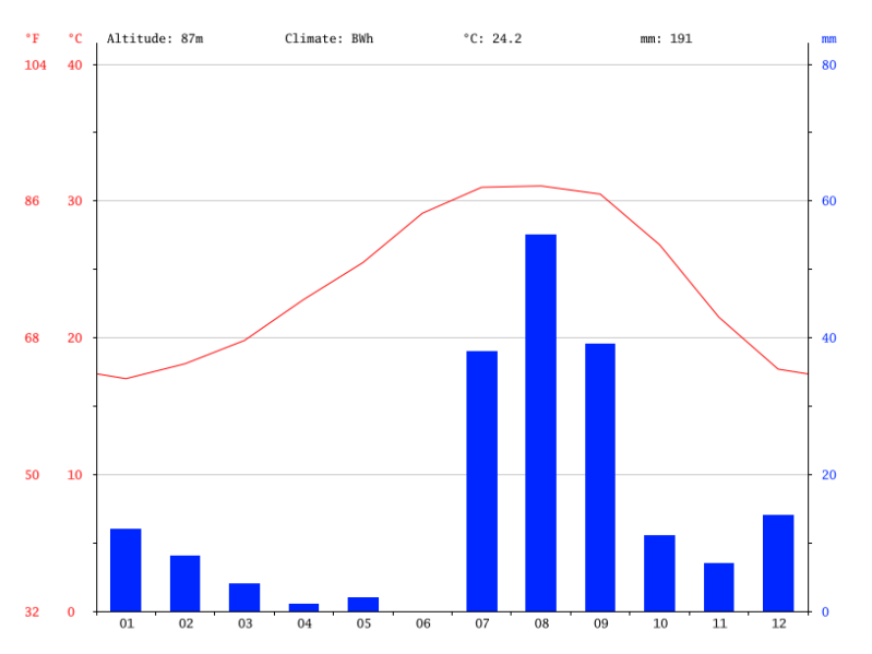
On the graph you can see that in July, August and September the highest precipitation is. And in the other months it rains a little bit.
It is near the equator because the temperature is very high. It's also above the equator, you can see it on the red line. When there is an topin the middle it is above, when it is more an valley it is under the equator.
It is there very cold when you go very high, because there is an high altitude . That’s why there is snow on the top of the mountain.
You can see on the graph that it is a BW, but it is a mountain so than it is a EH climate.
Maak jouw eigen website met JouwWeb